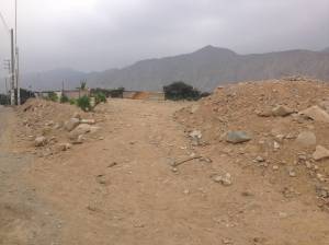
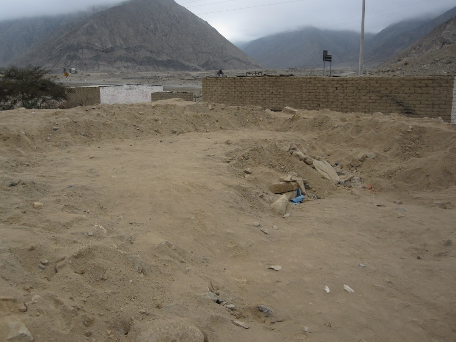
During the final week of my recent fieldwork in Peru I visited Huaricanga to look up old friends in the community. It was the first time I had been back to the site in three years. As I pulled into that old familiar “parking lot” I was a bit surprised to see that one of the mounds was not quite as tall as it was when I left it in 2012.
Mound B3 is an accumulation of residential architecture about 20 m away from where I did my dissertation research (Mound B2). In 2012, Mound B3 stood 4.5 m tall and it was from its summit where I used to set up the Total Station. As you can see in the photos below, most of Mound B3 has been destroyed.
An individual living at Huaricanga had decided to level the mound in order to bury a concrete tube in the ground and connect his/her home to the local sanitation pipeline. The bulldozer used to complete the destruction was still on site when I visited. The Peruvian Ministry of Culture had documented the incident and issued a denuncio, which equates to a sort of lawsuit that the individual will have to “fight” for the next several years. Many papers will be signed and trips to the town hall made. Ultimately, however, no tangible repercussions (e.g. fines or jail time) will be passed down and the damage to Mound B3 has already been done.
Although initially irate, the situation brought to mind some interesting ethical dilemmas. For example, can the local community decide on the fate of its own cultural heritage? Is it a crime to build a well, a school, or a hospital on a 5,000-year-old pile of stones and broken shell? What right, if any, does an archaeologist from thousands of miles away have to dictate how a community balances its current needs with its long-lost past?
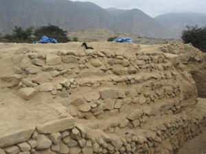
Fortunately, that other mound where myself and HARP team members spent six months of our lives was largely intact. As you can see from the photos below, the protective measures we took to preserve it (stone walls and backfill) have served their purpose thus far. I’m hoping Mound B2 will still be around during my next visit to Huaricanga.
To learn more about my recent fieldwork at the Late Archaic (3000-1800 B.C.) site of Caballete, which is just a short drive north from Huaricanga, check out the Caballete Archaeological Research Project (CARP) Facebook page or visit our website.


You raise some interesting points on cultural heritage preservation. My colleagues, Rebecca Bria and Elizabeth Cruzado Carranza have a major piece on “co-creation and community engagement that will be published in August in the SAA journal Advances in Archaeological Practices. They discuss our work in the small Ancash village of Hualcayán, Peru.
Here are a couple of my blog posts on this issue in Peru as well:
http://wp.me/pJf2X-1eK
http://wp.me/pJf2X-1d3
http://wp.me/pJf2X-19E
I am certainly familiar with PIARA and the fantastic work you’re doing at Hualcayán. Thanks for passing these blog posts along. I am curious, though, whether there was interest in the ancient history in the area before PIARA arrived on the scene or was it something that grew out of the work you all were doing there? Also, how does the “archaeology” (i.e. location of archaeological features) affect the day-to-day functioning of the village?